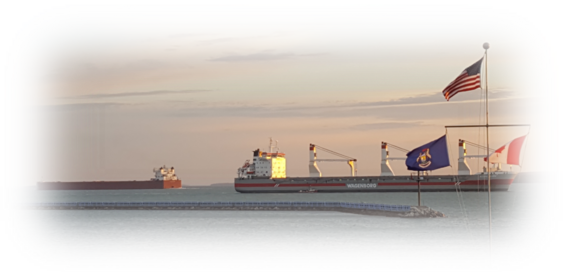
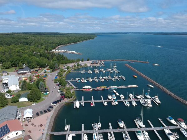
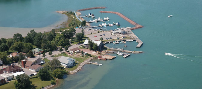
From the North Channel: After traveling along the north shore of Drummond Island, you will round Chippewa Point southward, entering Potagannissing Bay. The marked channel begins between Bruce Point and Propeller Island, starting with G21 to starboard and R22 to port. Continue on a southward course, following the green and red markers between Bald Island to starboard and Grape Island to port followed by Quarry Island to starboard and La Point Island to port. G11 to starboard, south of Quarry Island, marks a change in course heading westerly toward Rogg Island. Continue west to R8 to port which marks a change in course southward. Staight ahead, you will see the marina, brown buildings with silver metal roofs and a large American flag. At this point, you should see the privately maintained navigation aids (smaller green and red buoys) guiding you into the harbor entrance. Please note at this point, the change from green to port and red to starboard. G1 to port and R2 to starboard begin the fairway to our harbor. The entrance to the harbor is at the east end of the long, wood pier. As you clear the wood pier, stay to the west (right) of the floating dock system with a yellow flag at the end (attached to a large, brown boathouse). The fuel dock, marine travel lift, ship store, and boat ramp are all to the west (right) of that dock system. The floating fuel dock is straight ahead with a red flag at the end with both starboard and port ties available. Call us on channel 16 for further assistance in navigating this approach. From the west: Heading north, in the DeTour passage, along the west end of Drummond Island, you will find R2 to starboard northwest of Dix Point which is located on the northwest corner of Drummond Island. From R2 to starboard, head west between Bow Island and Surveyors Island finding G1 to port. Continue east, south of Gull Island, to G3 to port. Still on an east course, you will find G5 to port and R6 to starboard, both located north of Wreck Island. G7 to port is south of Howard Island and from there you will see the privately maintained navigation guides (smaller red and green buoys) starting with R1 to your starboard and G1 to port which begin the fairway to the harbor. Heading south, staight ahead, you will see the marina, brown buildings with silver metal roofs and a large American flag. The entrance to the harbor is at the east end of the long, wood pier. As you clear the wood pier, stay to the west (right) of the floating dock system with a yellow flag at the end (attached to a large, brown boathouse). The fuel dock, marine travel lift, ship store, and boat ramp are all to the west (right) of that dock system. The floating fuel dock is straight ahead with a red flag at the end with both starboard and port ties available. Call on channel 16 for further assistance in navigating this appoach. Dredging was done in 2012 to a depth of 9 or 10 feet