Explore 86 Miles of Trails Through Coastal Shrubland and Historic Landscapes
Explore 86 Miles of Trails Through Coastal Shrubland and Historic Landscapes
Fort Ord National Monument, situated on the Monterey Bay coast of California, is a verdant tapestry of rolling hills, chaparral pockets, and maritime grasslands that beckon travelers to immerse themselves in its natural and historical splendor. Once a bustling U.S. Army post, this 14,651-acre monument, designated by President Obama in 2012, now stands as a testament to conservation and recreational excellence.
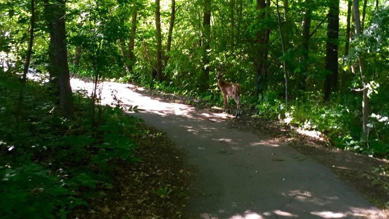
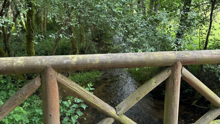
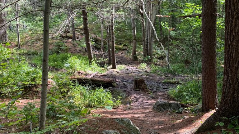
Hikers and mountain bikers can explore over 86 miles of trails, including the Creekside Terrace Trailhead, which offers scenic routes through diverse ecosystems. The landscape is alive with wildlife; mountain lions, deer, and eagles inhabit the area, while the endangered Smith’s blue butterfly and California tiger salamander find refuge here.
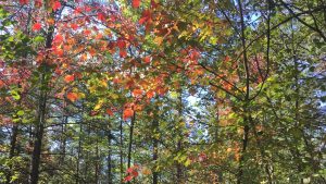
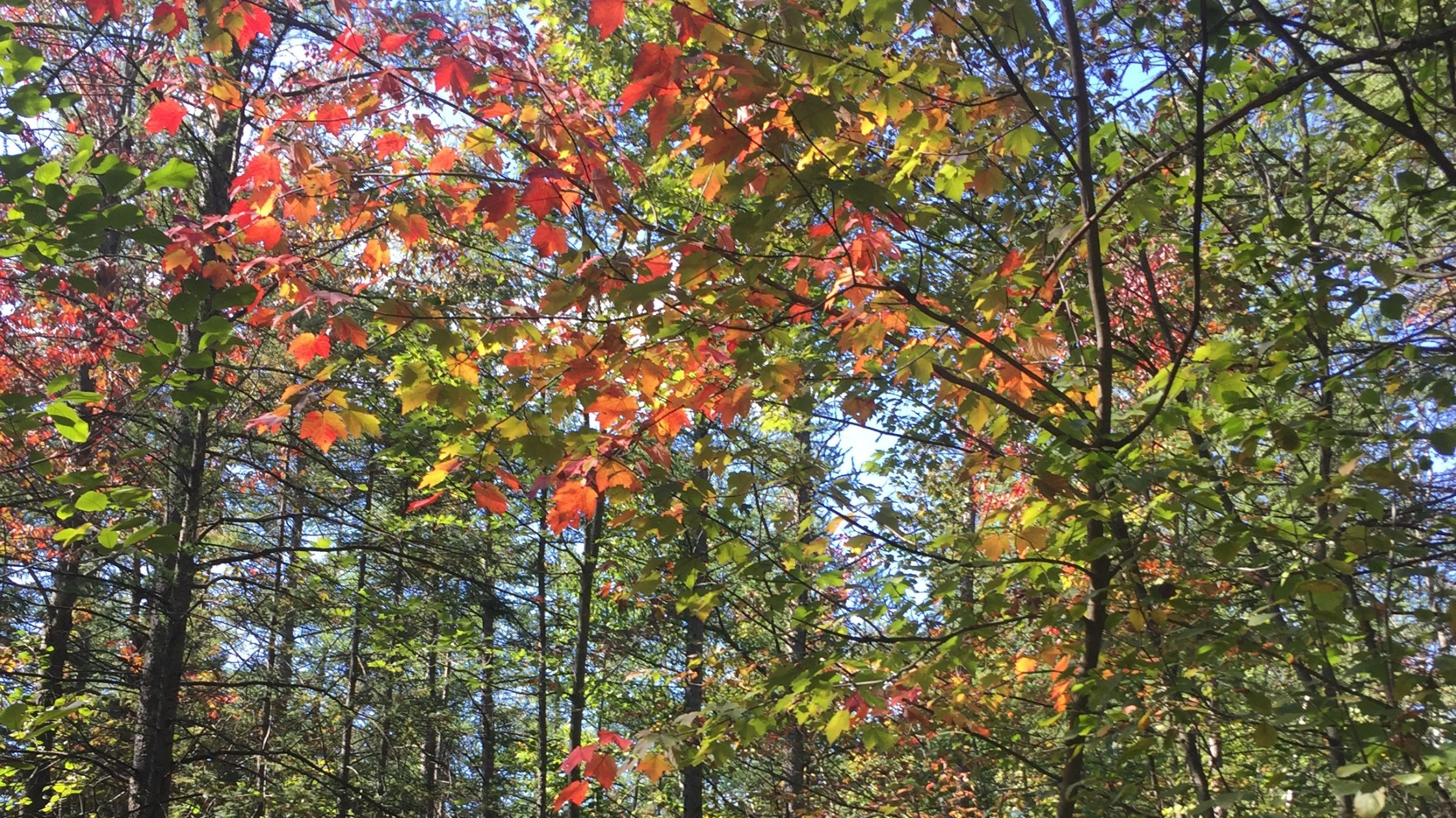
Seasonal changes paint the landscape in vibrant colors: the spring brings a bloom of Contra Costa goldfields, summer days are perfect for horseback riding, and autumn hues of chaparral scrub add warmth to the scenery. Winter months offer a serene backdrop for birdwatching and tranquil hikes.
The monument is also a hub for outdoor activities, with local outfitters offering horseback riding tours and mountain bike rentals. Nearby, the charming town of Monterey provides artisan shops, gourmet dining, and the world-renowned Monterey Bay Aquarium. For a deeper connection with nature, ranger-led tours and educational programs are available, highlighting the unique flora and fauna of the Central Coast Maritime chaparral ecosystem.
As the sun sets over Monterey Bay, the Fort Ord National Monument transforms into a breathtaking canvas of golden light and shadow, a place where history, nature, and adventure converge in perfect harmony.
Seasons
Spring brings mild temperatures (60s-70s°F) and blooming wildflowers. Join Earth Day celebrations in April, with events like Marina and Seaside Earth Day festivals. Ideal for hiking and cycling through lush grasslands and scenic trails.
Summer brings warm temperatures (60s-80s°F) and vibrant wildflowers. Join the Golden State 50K/35K/Half Marathon/10K in June, traversing rolling hills, chaparral, and grasslands under sunny skies. Ideal for hiking, biking, and horseback riding. Perfect for outdoor enthusiasts.
Visit in fall for mild temperatures (60s-70s°F) and clear skies. Enjoy National Public Lands Day events in October, featuring volunteer activities and community events, amidst the vibrant autumn hues of this diverse habitat. Ideal for outdoor enthusiasts and nature lovers.
Visit from December to February for mild winters, with temperatures in the 40s-60s Fahrenheit. Enjoy seasonal blooms and fewer crowds, though some trails may require wet crossings due to El Toro Creek’s winter flow. Ideal for a serene, nature-rich escape.
Top 3 Facts about Fort Ord National Monument
This former military base is home to the first nature reserve in the United States created specifically for the conservation of an insect, the endangered Smith’s blue butterfly, which inhabits a unique Central Coast Maritime chaparral ecosystem.
This coastal treasure is home to mountain lions, California badgers, and red foxes, while the skies are patrolled by vultures and red-tailed hawks. The terrain hosts a diverse array of flora, including rare species like the American water fern and various vernal pool plants. The landscape is also dotted with unique fauna such as the Monterey ornate shrew, adding to the rich biodiversity of this natural haven.
In this coastal terrain, older consolidated rocks exposed at the southern base give way to younger, unconsolidated sediments in the north, creating a striking geological transition. The area straddles two distinct groundwater basins, the Salinas and Seaside basins, with the Salinas basin underlying the northern and southeastern portions. Here, you’ll find Quaternary dune sand deposits and Aromas Sands, weakly-consolidated and well-sorted, dating back to the late Holocene or early Pleistocene. The landscape is defined by northwest-trending mountain ranges and broad basins, offering a unique blend of rugged hills and coastal lowlands.
Travel Tips
Plan Ahead
Plan a few days in spring to explore 86 miles of trails, from grassy hills to coastal shrubland. Arrive early, park at designated trailheads, and visit the visitor center. Pack meals and rest often. Enjoy wildflowers and scenic views during the annual Blooming Wildflowers event.
Pack Appropriately
Pack layers for variable weather, sturdy hiking boots, and a waterproof jacket. Bring a daypack with essentials like water, snacks, and a first-aid kit. For camping, include a tent, sleeping bag, and headlamp. Check the season for specific gear needs.
Respect Wildlife
Respect the unique maritime chaparral and wildlife by staying on trails, avoiding sensitive habitats, and not disturbing rare plants like Contra Costa goldfields. Be mindful of seasonal nesting and breeding periods. Leave nothing behind but footprints, take nothing but memories.
Stay Informed
Check weather forecasts and fire restrictions before heading out. Wear appropriate clothing, stay on marked trails, and avoid ledges and fast-moving water. Carry a first aid kit and know basic first aid. For emergencies, call 911 or park authorities at 831-582-2200. Stay informed and exercise caution.
- Area (mi²)
- 23
- Annual visitors
- 1 100 000
- Established year
- 2012
Accessibility & permits
Emergency
Planning a trip?
Tell us about your upcoming trip and how we can help!


Frequently Asked Questions
Ready to dive into what Fort Ord National Monument has to offer? Let’s tackle some of the burning questions you might have as you plan your visit!
-
The closest city to Fort Ord National Monument is Seaside, California. This area is also near other cities like Salinas and Monterey, all within the Monterey Bay region. Fort Ord is situated in an area that was once a U.S. Army post, which closed in 1994.
-
Dogs must be on a leash no longer than 6 feet at all times. They are not allowed off-leash and must be under control. Dogs are also not permitted in the Inland Range Planning Unit.
-
Parking is free, but be aware of specific access points and trailhead parking areas. Parking lots are available at various trailheads such as the Creekside Terrace Trailhead and the Badger Hills Trailhead.
-
You can hike, bike, or ride horses through the rolling hills, chaparral, and grasslands of this area. The trails, including segments of the historic Anza Trail, offer scenic views and a glimpse into the native grasslands before European settlement. The monument also features trailheads like Creekside Terrace and Badger Hills with amenities such as restrooms, maps, and interpretive displays.