
The Complete 2025 Guide to Every View — and How to Reach Them
Gatlinburg sits at the edge of Great Smoky Mountains National Park, where a maze of ridgelines, balds, fire towers, and scenic pull-outs reveals one jaw-dropping view after another.
From the iconic Gatlinburg Scenic Overlook just outside town to sweeping vistas at Campbell Overlook, Sugarlands Valley Overlook, Newfound Gap, and the sunset-famous Morton Overlook, this is a region built for slow drives, spontaneous stops, and panoramic wonder.
This guide walks you through more than two dozen overlooks, grouped by ease of access, mobility needs, sunrise or sunset orientation, kid‑safety, and parking capacity, so you can mix‑and‑match stops into an unforgettable day—or a week—of cloud‑level sightseeing.
Every lookout listed is reachable from downtown Gatlinburg within 90 minutes, and each paragraph includes practical tips on timing, gear, and comforts.
Before you lace up, know that the Park It Forward program requires a $5 daily parking tag (or $15 weekly/$40 annual) to leave any vehicle for longer than 15 minutes inside the national park. Pick one up at automated kiosks, visitor center counters, or online and display it on your dashboard.
Easiest Drive‑Up Views
Little Effort, Big Panorama
Gatlinburg Scenic Overlook
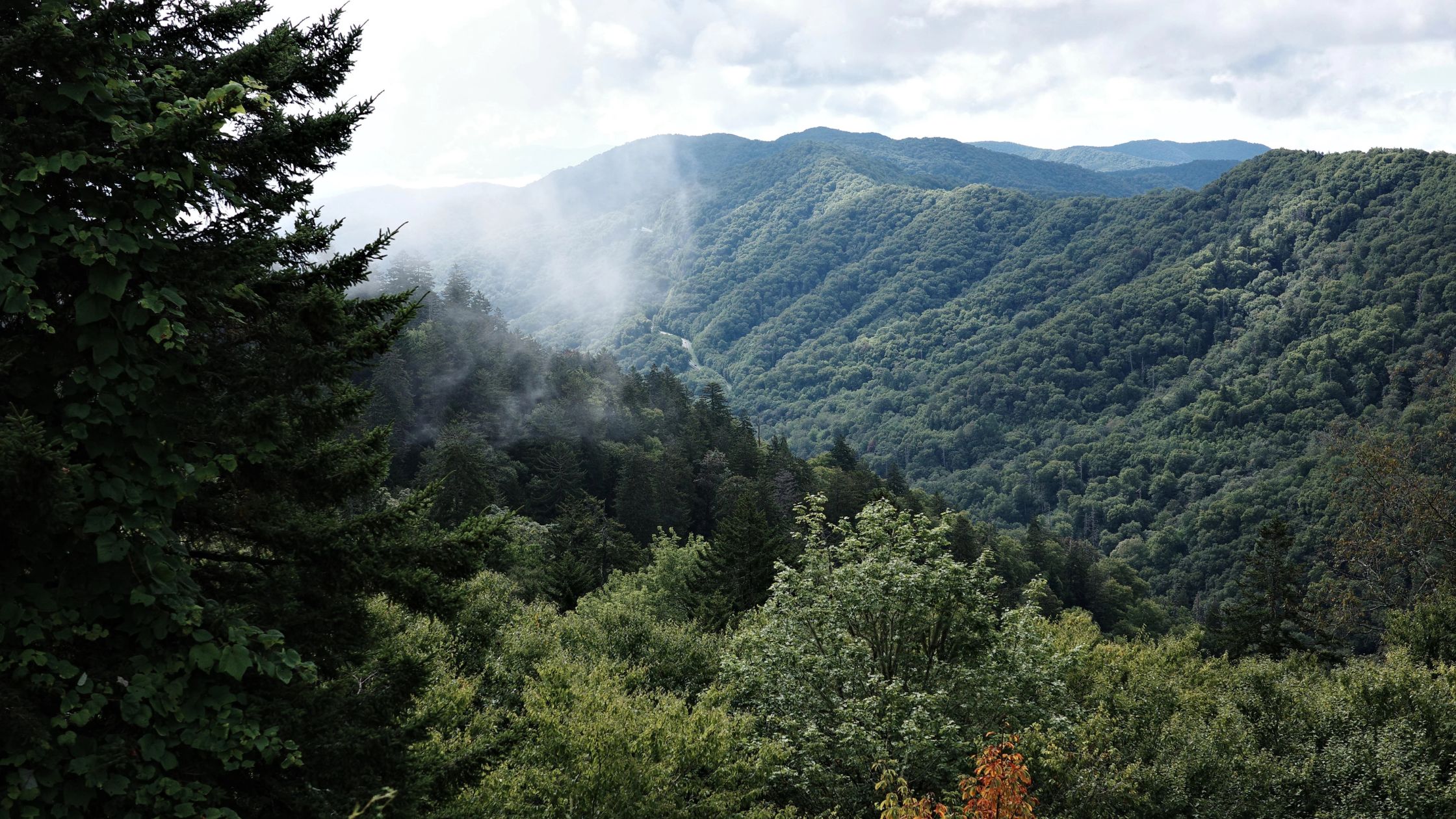
Less than five minutes from downtown, the Bypass features four paved pull‑outs with postcard views of Gatlinburg’s rooftops framed by Mount Le Conte’s hemlock‑draped massif. All lots have level asphalt, low guardrails, and interpretive panels—no restrooms, no fees, and the city lights sparkle after dark. Arrive at dawn for soft alpenglow without the tour‑bus hustle. Bring a tripod: the wide shoulder lets you step back for group portraits without blocking traffic.
Campbell Overlook
Only 2.2 miles beyond Sugarlands Visitor Center on US‑441, Campbell Overlook presents a head‑on view of Mount Le Conte’s rugged profile. A short sidewalk keeps kids off the road, parking is free but limited (for ten cars), and no facilities are available. Early morning is ideal for golden‑hour shots; by 10 a.m., shadows swallow foreground ridges.
Sugarlands Valley Overlook
Immediately past Campbell, pull into this ADA‑friendly lay‑by for valley‑floor vistas and interpretive signage on historic CCC stone walls. A paved, flat loop trail wanders through cove hardwood forest if you need to stretch your legs, and the Sugarlands Visitor Center (restrooms, water, maps) is three minutes downhill.
Newfound Gap Overlook
Straddling the Tennessee–North Carolina line at 5,046 feet, Newfound Gap delivers 270‑degree vistas and ample parking for buses and RVs. Restrooms, picnic tables, and a Rockefeller memorial plaza make this a linger‑worthy stop. Bring quarters for the mounted binoculars and a wind‑proof jacket—the gap is often 10‑15 °F cooler than Gatlinburg.
Morton Overlook
A mere 0.8 mile beyond Newfound Gap when traveling toward Cherokee, Morton Overlook is Gatlinburg’s classic sunset pullover. Fifteen slots fill an hour before dusk; arrive early with camp chairs and a thermos of cocoa. No restrooms, but the short stone wall acts as a safe barrier for children.
Foothills Parkway Pull‑Outs
The 16‑mile “Missing Link” between Wears Valley and Walland flaunts a dozen roomy overlooks—Emerine Gap is the only one with views north to the Cumberland Plateau and south to the Smokies. Pavement is smooth, parking is plentiful, and crowd levels are lighter than on US‑441. Pack picnic fixings and stop where the light feels right; autumn color here is legendary.
Look Rock Observation Tower
Exit the Foothills at the signed Look Rock parking area. A half‑mile paved ramp spirals to a 360‑degree concrete tower with interpretive panels, perfect for wheelchairs and strollers (though the grade is steady). Seasonal restrooms are five minutes away at the former picnic area. Bring binoculars; on clear days, you can spot Clingmans Dome 26 miles east.
Cades Cove Scenic Overlook
Halfway around the 11-mile loop, a pull-off on the left reveals an elevated perspective of pastoral fields hemmed in by towering ridges—a favorite spot for telephoto wildlife shots at dawn. Parking is limited and shoulder-style; weekdays before 8 a.m. are the quietest. Pack insect repellent and telephoto lenses for bear sightings.
Fully Accessible Lookouts
Wheelchair or Limited‑Mobility Friendly
- Gatlinburg Scenic Overlook – Flat pavement right beside the guardrail.
- Newfound Gap Walkway – Wide, gently graded sidewalk connecting both ends of the lot; telescopes at waist height.
- Look Rock Tower – Paved ramp, no steps.
- SkyLift Park & SkyBridge – The chairlift slows for boarding; the mountaintop plaza, gift shop, and record-long 680-foot glass-panel bridge are ADA-compliant. Arrive at opening to dodge afternoon queues and pack a light jacket—the summit sits 1,800 feet above town.
- Anakeesta’s AnaVista Tower (ticketed) – Elevator‑equipped to the observation deck, plus café, restrooms, and shopping below.
- Sugarlands Valley Nature Trail – A flat, 0.5‑mile paved loop with gentle stream views.
Bring collapsible trekking poles for companions who need occasional balance support, slip‑on layers, and a lightweight lap blanket for breezy summits, regardless of what time of year you’re visiting Gatlinburg.
Overlooks Accessible Only by Hiking
Inspiration Point via Alum Cave Trail
Hiking Distance: 2 miles one way, moderate
Climb stone stair‑steps and pass through rhododendron tunnels to a cliff‑edge ledge showcasing Little Duck Hawk Ridge. Continue another 0.1 mile to Alum Cave Bluffs for a shady snack break. Expect 3–4 hours round‑trip, carry 2 liters of water, and arrive before 8 a.m. to beat parking congestion.
Chimney Tops Observation Deck
Hiking Distance: 3.5 miles round‑trip, strenuous
A relentless stair climb ends at a safe fenced platform built after the 2016 wildfire. Views sweep across Mount Le Conte and the twin pinnacles. Start early; trailhead lots fill by 9 a.m., and park shuttles cut stress.
Andrews Bald
Hiking Distance: 3.6 miles round‑trip, moderate
From the far end of the Kuwohi parking lot (formerly Clingmans Dome), follow Forney Ridge Trail to a high‑elevation grassy bald carpeted in azalea and bluets in June. Carry a picnic blanket—this is one of few summits with soft ground for lounging.
Charlies Bunion
Hiking Distance: 8 miles round‑trip, moderate
Begin at Newfound Gap’s Appalachian Trailhead and crest Masa Knob before scrambling onto an exposed rock prow with thousand‑foot drop‑offs on three sides. Expect wind, pack a puffy layer, and allot five to six hours, including photo time.
Cliff Tops and Myrtle Point, Mount Le Conte
Hiking Distance: 11 miles round‑trip, challenging
Stay overnight at Le Conte Lodge—or tackle a predawn climb—to catch first light from Myrtle Point’s east‑facing outcrop and final glow from Cliff Tops’ quartzite slab. Each spur is 0.2 miles from the lodge, so save energy for the final push.
Mount Cammerer Fire Tower
Hiking Distance: 11 miles round‑trip, challenging, but worth it!
Starting at Cosby Campground, grind up Low Gap Trail, then stroll the Appalachian Trail ridge to a 1930s stone lookout offering 360‑degree panoramas of Pigeon River Gorge. Pack 3–4 liters of water, a headlamp for contingency, and plenty of calories; the loop gains more than 3,000 feet.
Where to Greet the Sun
| Sunrise Spot | Why It Shines | Gear & Timing |
|---|---|---|
| Kuwohi (Clingmans Dome) Parking Lot | 100‑mile sightlines on crystal mornings; no hike needed | Arrive 45 minutes before official sunrise, bring gloves and hot drink. |
| Myrtle Point, Mount Le Conte | 270‑degree east exposure with pastel ridges | Start the night hike by 3 a.m. in summer; micro‑spikes in April. |
| Foothills Parkway East Pull‑Outs | Uncrowded, gentle grade right off the pavement | Keep headlights low and watch for deer; pack folding stools. |
| Newfound Gap Upper Lot | Watch dawn spill across North Carolina valleys while standing in two states | Bring ND filters; avoid weekdays after 7 a.m. due to traffic. |
| Little River Road Pullouts | River mist and mountain layers—great for long‑exposure photography | Quick hop from downtown for a glowing city‑lights‑to‑daylight transition |
| Gatlinburg Scenic Overlook | Quick hop from downtown for glowing city‑lights‑to‑daylight transition | Tripod, extra battery, and breakfast pastries to go. |
Where to See the Sunset
- Morton Overlook – The classic Smokies silhouette shot; parking full an hour early.
- Cliff Tops – Walk 0.25 mile from Le Conte Lodge; sheer drop and fiery horizons.
- Look Rock Tower – Less crowded than Morton, with a 360‑degree vantage; note seasonal restroom closure.
- Foothills Parkway West pull‑outs – Face west toward the Cumberland Plateau; wide lots fit RVs.
- Gatlinburg Scenic Overlook – Watch cabin lights flicker on across the valley; bring a wool layer even in July.
- Cades Cove Overlook – Late‑afternoon haze and silhouettes of grazing deer; plan around loop‑road traffic closures.
Kid‑Safe and Low‑Stress Overlooks
- Gatlinburg Scenic Overlook – zero drop‑offs, ample shoulder width.
- Newfound Gap Walkway – Guardrails, restrooms, and an ice‑cream truck on weekends.
- Look Rock Tower – Gentle ramp, fencing all around the platform.
- Sugarlands Valley Nature Trail – Creek‑side benches and flat asphalt.
- SkyLift Park – Secure fencing, staffed chairlift operators, and onsite café for quick snacks.
Pack: child‑sized binoculars, sun hats, and an inexpensive digital camera so little explorers can capture their own angles.
Overlooks with the Most Parking
- Newfound Gap – Holds more than 100 vehicles and tour buses.
- Kuwohi (Clingmans Dome) Lot – Expansive but still full by 10 a.m. in July; save it for late afternoon.
- Emerine Gap on Foothills Parkway – Dual‑sided lot with RV capacity
- Cades Cove Overlook – Long shoulder that accommodates overflow when loop traffic pauses.
- Look Rock – 50+ spaces lining both sides of the access spur.
What to Pack
Even for a Ten‑Minute Stop
- Lightweight waterproof shell and insulating mid‑layer
- Trail runners or sturdy walking shoes; stone overlooks can be slick
- Headlamp for dawn or dusk visits
- Microspikes November–April above 4,500 ft
- 1–2 liters of water per person; filtered refill at Sugarlands VC
- High‑energy snacks or a packed picnic—many overlooks lack concessions
- Compact travel blanket, camp chairs, and a fully charged power bank
- DSLR or phone with manual‑exposure capability, polarizing filter, and lens cloth
One‑Day Scenic Itinerary
Start your day early with a breathtaking sunrise at the Gatlinburg Scenic Overlook, where the first light spills over the Smoky Mountains in soft, golden hues. Afterward, head back into town for a hearty Southern breakfast—try the pancakes at Crockett’s Breakfast Camp or the griddle specials at Log Cabin Pancake House.
From there, cruise south along US-441, taking time to stop at the Campbell and Sugarlands Valley overlooks for sweeping, photo-worthy views. For your morning adventure, lace up your boots and tackle the 3.6-mile round-trip hike to Andrews Bald. This high-elevation meadow is the perfect setting for a mid-morning picnic surrounded by wildflowers and mountain vistas.
Continue your journey with a stop at Newfound Gap for a casual lunch—restrooms and interpretive signs make it a scenic and educational break. As you descend, take a detour onto the Foothills Parkway and climb the short trail to Look Rock Tower for panoramic views that stretch across Tennessee’s western ridgelines.
Cap off your day with a dramatic sunset at Morton Overlook, one of the Smokies’ most iconic viewpoints. When the afterglow fades, head back to Gatlinburg for dinner—whether you’re in the mood for Appalachian trout at The Greenbrier or moonshine BBQ at Bones, you’ve earned it.
Feeling ambitious? Trade Andrews Bald for the eight-mile trek to Charlies Bunion. It’s a five-hour hike with big payoffs—think rugged ridgelines and epic photo ops.
Where to Rest Your Head
After a day of ridge‑hopping, sink into a hot‑tub‑equipped cabin overlooking the same peaks you explored. Browse Lake.com for mountain homes in Tennessee, including in Chalet Village (five minutes from the Bypass), riverfront lodges along the Little Pigeon, or high‑elevation stunners in Wears Valley. Filter by sunrise deck, EV charger, or pet‑friendly amenities, and lock in mid‑week dates to save up to 20 percent during foliage season.
Ready to Point Your Lens Skyward?
Whether you crave a roll‑out‑of‑the‑car vista or a calf‑burning ascent to a 1930s fire tower, Gatlinburg offers a layered portfolio of overlooks that promise new angles each hour of the day.
When you’re done chasing horizons, your lakeside cabin is waiting—wood‑stove glowing, porch rockers swaying, and tomorrow’s dawn ready to paint the peaks all over again.